Wednesday, July 29, 2009

401 Via Snodgrass

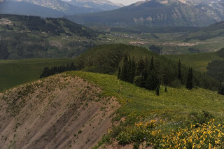
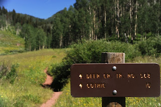
Im running a little behind on the blog, plenty of excuses but no need for them here. We had our last ride in Crested Butte on Saturday although Pooh and T were sticking around a few more days and I hear had a great ride on Doctor's Park. Anyways, they still needed to do the classic 401 ride and since it is rather short by itself we decided to start near the Snodgrass trailhead and start and finish with it. A short gravel road ride and a climb up through a grazing pasture put us in the Aspen as pictured above. Phoenix Scott came on the ride but State College Scott opted to head over to do some desert riding at Hartman Rocks since he had already done these two trails. A few miles through the Aspen on great track, some climbing then down a bit of a dirt road and we were on Gothic Rd. A couple slight downhill miles to Gothic then the climb to schofield pass. It was a Saturday so we expected some company but it was just crazy. The normal parking spot, there just past Gothic was full to over flowing already and the number of cars creeping up Gothic road was unreal.

Pooh had been riding really strong so far so he went first and followed up the singletrack climb to the fun stuff. Its a real grunt but makeable, HO, David and I had all done it last year. We waited a couple minutes for the rest of the group to get up and howie went ahead to get some pics of us coming up. At that point a huge group of riders, probably close to 20 who were in for a wedding caught up to us, heres a few of them behind T.
Then its across the benchcut, just have to be careful not gawk at the views too much


Then down through aspen groves on switch backs, often with the wild flowers as high as your shoulders

The ride sort of "kisses" Gothic Rd before heading back up then down at Gothic. T was starting to feel all the riding and wanted to save some legs for the next few days so she headed back into town down Gothic Rd at that point. We had left and extra vehicle in case anybody needed to bail. Pooh continued to ride super strong making all the short and not so short grunts in this section. I kept up with him for the most part, hoping that he would get off the bike and give me an excuse to do the same but never happened. I did fail to make one, as my front wheel got up and wandered off trail. Down to Gothic, chatting with some of the wedding guests at the end. It was a couple miles slightly back up Gothic road to head back on Snodgrass. The thought of another 1000 feet of climbing was a little more that phoenix scott was up for so he bailed back the road into town and found T, both were waiting for us at the Brick Oven when we got back. The ride back Snodgrass was great, getting most of the climbing out of the way at the beginning and getting to really roll through the aspen the way it was meant to be ridden. 30 miles later we were back at the truck with an estimated climbing of about 4000 feet.
Pooh gave it huge thumbs up, saying that it was probably the prettiest ride he had ever done, and he has done alot out west with us over the years.
We shared some pizza and then headed back to camp, Pooh had broken a chainring bolt early on so he need to get that fixed.

Sunday, July 26, 2009

Return to Reno


Well Im catching up on the blog since internet was not right at the the RV at the last place. It was the second day of Pooh and Terri joining us and we decided to to take them on another crested butte classic, the one that howie and I previewed earlier, Reno, Flag, Bear, Deadman. Howie decided that he needed to take the day to work and Phoenix Scott did the family values thing. The pics are in reverse order, but Im just being too lazy to reload them in the right order and cannot for the life of me figure out how to easily swap them. Anyways, the second picture Scott took on the way to the top of Reno Divide and the first is at the bottom of the climb up Deadman's. The ride started early with a chilly 44 degrees, there were a few slight downhills on the road to start which we kept as slow as possible to stay as warm as possible since we were all in short sleeves and shorts. We passed a couple of campers heading down to the creek that made comment about us starting early. The climb is 1700 feet and Terri made it like a champ. The road has some seriously steep parts that had me walking my first time in crested butte. Scott and I got out in front and I was expecting to wait a good long time at the top but to my surprise and amazement, pooh and Terri pulled in at the top no more than five minutes after Scott and I got there. Really awesome. So down we went, the trails actually dustier than I had ever seen, but no mud and no cows. The climb up bear was its usual toughness, Scott doing very well on a bunch of the tough ups. Terri still had a smile on her face even with pooh showing her up on the last little grunt, bad pooh bear. A little road then all smiles down bear through the meadow. The trail gets a bit steeper, I took lead since I knew it a better and already had good video footage of it. I stopped after a creek crossing to wait up for the rest, Scott, then Pooh, who said Terri was right behind as she stopped to walk a gnarly section, but after her arrival, I assured her that howie walked that section too. Some more nice single track down to the intersection with Deadman's (note Scott's second picture). Terri held in like a champ up this 700 foot single track climb. We all had fun down the well laid out switchbacks down to the waiting vehicle.

Friday, July 24, 2009

Monarch Crest, Silver Creek Rainbow Trail

Well as you can see from the picture, we have added to our masses. State College Scott is the one sitting down on the right, Ive got my arms folded, Phoenix Scott is in white, and Pooh and Terri are in the matching jerseys (isn't that cute). I've described the ride somewhat before, but big kudos go out to Terri for doing so well on her first ride at altitude having only been riding mountain bikes for less than a year.


Its not apparent from the photos, but off to our left clouds were starting to build and we were getting a little worried about storm potential. We ended up making it across the ridge to Silver Creek which we took down the mountain without even hearing any thunder so we were happy about that. Everyone successfully managed their way down silver creek including the part at the end where the trail is silver creek for a bit. Phoenix Scott was feeling pretty worked over so he opted for the road down from there while the 5 of us headed across Rainbow Trail. No pics as its just too much fun to stop. We felt a few sprinkles and down the mountain Scott actually had to put his rain jacket on for a bit, but no harm no foul. It had actually rained on part of Rainbow before we got to it which knocked down the dust and made things a little more tacky. After 6 miles of Rainbow there was a bailout down to the road, missing the last 3 miles, which honestly aren't nearly as fun as the previous 6 and end with a very technical set of switchbacks, so Terri and I opted for that option leaving 3 to finish up the trail. We all met back down at the truck in Poncha Springs after 35 miles of riding.

401 Wednesday


Sorry, got a little behind. On Wednesday, I took the day off to work and Howie, Scott, and Scott II (a guy we met last year in durango and is here at the same campground with us now) headed up to do the classic 401 ride. Howie says he is gonna do a post but we'll see, so check back later for more verbiage, but for now enjoy the pictures.

Wednesday, July 22, 2009

Snodgrass to Deer Creek

Well we ended up not riding Monday as the weather was not looking great and howie and I needed a rest day anyways. Scott went and checked out Black Canyon on the Gunnison National Park.
For Tuesday we wanted to show Scott the Deer Creek ride but we didn't feel like dealing with the climb we did especially all the stupid deer flies. We also wanted to check out another trail, Snodgrass, that runs between Washington Gultch and the drainage Deer Creek ends in. The plan was to park in Crested Butte, ride out Washington Gultch about 5 miles, pick up Snodgrass, take that over to the "end" of the Deer Creek trail and do an out n back on that.
Snodgrass is a no motorcycle trail so its in really good shape winding in and out of the Aspen and as we rode it, finishes up down a dirt road just above Mt Crested Butte.
A couple miles out Gothic road and we were at the trailhead, already with about 12 miles and 1200 feet or so of climbing in.
Deer Creek's tread is also in really good shape due to no moto's on it either. Going this way it starts with a climb through a tall grass meadow, tall being about handlebar height for the most part. We hit the aspen and kept climbing from about 9400 to 9900 feet where the trail levels out and follows that contour for a mile or so, a welcome break. Up through more open field and aspen to about 10,200 and again levels out for a bit, going by some stock ponds. There was a couple hundred foot decent down to a creek crossing with the matching climb on the other side. At one point Howie did manage to fall over in a muddy creek crossing, just picture pig pen from the Peanuts cartoon. The final climb took us up to about 10,600 just past what is pictured below


2 hours after we started the climb we were at the top. We didn't spend too much time there as the deer flies started to congregate so we ate some fluffer nutters and then headed back down, this being our first big view. We all agreed the ride down was a lot more fun, although still requiring some work. I also managed to find a tombstone with my front wheel going around a turn that sent me into the weeds, but just a little rock rash on my leg. Scott decided to forgo the bonus mileage at the end, that being Upper trail and Tony's trail so we opted for the easier bike path from Mt Crested Butte down to the truck in Crested Butte. Total of about 6 hours, 35 miles, and 4200 feet of climbing.
Howie dropped his bike at the Alpineer outdoor and bike shop to get his rear brake bled then we walked over to get a little pizza at the Brick Oven before heading back to camp

Monday, July 20, 2009

Doctor's Park Death March

Well the ride was Scott's first so the obvious choice would be a nice relatively short "welcome to altitude" ride, but that's not what happened. We had planned to the Doctor's Park downhill, a great ride that we have done a couple other times. The typical way of doing it is either ride or shuttle up about 8 miles and a little over 1000 feet up Spring Creek Road where you ford Spring Creek then head up another 1000 feet on steeper dirt roads before heading back down, very reasonable ride. Not what we did. Howie and I had been concocting a way to incorporate a trail called Cement Mountain Trail as well as getting to go down Deadman's gultch trail. There was a road, Roaring Judy rd, that went up the mountain from near where we park for Doctor's Park up to Cement Mountain Road so we were all good. The issue was elevation gain, lots of it. The first couple miles were quite pleasant which did not bode well for the next few since we knew how high we had to get. We hiked most of the next few miles getting to ride some of it. 2 hours later and 7 miles later we were at Cement Mtn trailhead at about 10,500 feet. Not fun but not unbearable. Our next landmark was the trail intersection with Rosebud at 11,000 feet, 4 miles away, no problem. Well what we neglected to notice on the map was a saddle point between there 11,600 so it was a lot steeper than we had anticipated and the motorcycles had a lot of it too chewed up to ride. So 3 hours and 3200 feet later we crested Cement Mtn trail. The downhill to rosebud wasnt a lot of fun since it was steep and also really chewed up by the motos. At least at Rosebud we knew all was good for a while traversing open meadow hillsides and heading down through some pine forests. Although over all it was down hill to Deadman's we still had some ups that worked our tired legs. Deadman's, which we have climbed a number of times as part of the reno, flag, bear, deadman's loop, lived up to expectations and was a really fun downhill as its a gentle enough grade that the motos have not rutted and loosened it up like so many other trails. The first two pictures are on the lower section of Deadman's.

The bottom of deadman's funneled us out via a very rough road on to Spring Creek rd about 3/4 of a mile below where we needed to ford Spring Creek so up we went. There were two different groups of riders there, both having shuttled up to that point. Howie was completely out of water and Scott and I were low so we pulled out the filter and filled the camlebaks with Spring Creek water. It was "only" 1000 feet up at that point but I was feeling pretty spent. It was also getting pretty warm out and the sun was beating on us during this open dirt road climb.

Here's the view as you finish the majority of that climb.
A little bit more open road, then some forested road, up and down a bit, every up seemingly taking the last bit of energy I had.
We finally break out into the open that signals the start of the decent. Somewhere in the neighborhood of 8 miles, almost all downhill. It starts with some steeper switchbacks, then some exposed benchcut, a rocky sections then into some really nice smooth aspen sections

Howie was starting to loose his rear brake again so he was taking it on the easy side. The ride ends down a series of switchbacks basically carved into the side of the rock face, good technical fun. All told, 7.5 hours, 5200 feet of climbing and about 32 miles.
We finished the ride just as one of the other groups was finishing as well and as we were loading up the truck one of them asked if we were shuttling, that is had to drive back up Spring Creek Rd because they had left the keys to their shuttle vehicle in the car up Spring Creek, we said no, but we offered to drive one of them up. So Dana, a local of about two years, hopped in and we took him on up. He filled us in some other potential rides and the group also offered to buy us a beer at the bar at the little resort place at the bottom of Spring Creek. So we had an enjoyable time sipping on a really good ESB, talking with Dana, his cute redheaded girl friend, and a couple other guys sitting the tavern's deck overlooking Taylor Creek, a really nice way to finish a long day of riding.

Saturday, July 18, 2009

Deer Creek Trail


Today's ride was the Deer Creek Trail loop, aka as the ride that almost killed the meeker madness. We had not done this ride the past two years, only about 8 years ago with our buddy Chris Meeker on our second big trip out west. It begins up Brush Creek, following that road up about 5 miles or so as it starts very level and very passable to quite steep and only suitable for high clearance jeeps. It winds up through a very beautiful open meadow valley eventually finding single track and heading up the deer creek valley.

The first mile, while steep was rideable and still somewhat enjoyable. The next half mile pretty much sucked as it was a hike a bike up through aspen finally topping out at a saddle point at 10,600 feet, starting at 8600 feet with a 200 foot up an down in there. Basically the ride went around Mt Crested Butte, and this vista was of the ski village we eventually make it back down to. The deer flies were terrible so we didn't stick around along. Down then up then down then up we went, more down than up for a few miles with views like this


we wound our way down through aspen and fields of wild flowers and 10 miles after we hit the single track we popped out on Gothic road, just below the town. A car had just pulled up and one to the occupants asked if it was OK to park there. We said sure, but don't trust us. He noticed my NMBA jersey and said he had just road the tues and wed evening group rides in State College last week. We talked a bit more then were on our way, heading down, actually up, the road to Mount Crested Butte where we picked up Upper Trail, then Upper Upper trail, which took us back to Brush Creek Road and the waiting beast. We didn't expect quite the amount of climbing in this section, a good 400 feet but it was all good.
Total of about 25 miles, 4.5 hours or so and something in the neighborhood of 4000 feet of climbing.

Friday, July 17, 2009

Reno Flag Bear Deadman with bonus mileage

We had done today's ride a few other times and plan to do it with the rest of the crew once they are all assembled here in the gunnison/ crested butte area. But we had heard some reports that cattle grazing had seriously compromised one of the trails on the ride so we decided to go check it out ourselves. The ride starts about a 20 minute vehicle ride up the Cement Creek Drainage, then follows that up the road on bikes for another mile or so before turning skyward over the reno divide. 5 miles and 1700 vertical feet later you crest the ridge where we met up with some motorcycle riders and had a little chat. We headed down Flag Creek trail which was in fine shape just having to avoid a few cow patties and later on convince a few heifers that they really need to get off the trail and let us get by. Down past the beaver ponds then across a stream crossing before we started up Bear Creek trail. We saw a little evidence of grazing but the trail was in fine shape and up we climbed. Other than a few very steep sections, its a rather pleasant climb along the edge of a stream meadow valley. A quick ride along a dirt road and we headed down the continuation of Bear Creek trail. This heads across a wide valley at a mellow decent for a mile or so then starts to head down at a steeper rate along the creek. This intersects with Deadman's gultch were we took a right and climbed up again, great scenery along a stream with numerous beaver dams. Near the top of the ridge, a trail comes in from the left, Cement Mountain Trail. We had followed this the other direction a couple years ago when we did a bonus loop up Rosebud trail, but that climb really sucked as it was really loose and full of babyhead rocks due to all the motorcycles. We really wanted to Cement Mtn again but did not want to do Rosebud so we did an out n back from Deadman's. The first half mile was rough, almost all hike-a-bike but then mellowed after that affording us views like this


The bonus riding added about 7 miles or so taking us to a total of about 27 and an extra 700 feet or so of climbing.
Howie broke a spoke on the initial climb so after the ride we headed back to camp to clean his bike up and then head into gunnison to see about a spoke as well as potentially getting his rear brake bled. We also decided to check in on a favorite pizza spot from our previous visits, still just as good.

Thursday, July 16, 2009

monarch crest part 2


theres still a bunch more video, its the hardes thing paring down a few hours worth of amazing views to a few minutes but I hope you get the gist
feel free to comment if the videos either take forever to load or cause the main page to load slowly, I can figure something else out if its an issue

monarch video part 1


well today we went from the campground at Chalk Creek to the Tall Texan Campground in Gunnison CO, about 90 miles away give or take. Howie had some conf calls to take care of and I wasn't pushing for a ride since I was feeling a little spent after yesterday. So I edited a little bit of video. It doesn't do the ride justice, but its still pretty cool I think

Wednesday, July 15, 2009

Monarch Crest Part 1

Well the initial plan for today was to drive up to the Monarch Pass and head north on the Continental Divide Trail. Its not a normal ride and even one of the guide books mentions that you will be using your bike alot as a very expensive walking stick. The forecast looked reasonable but by the time we got up there, a little after 8 in the morning, it was already starting to look rather iffy in that direction. A few other riders intending to do the normal monarch crest ride rolled in and upon talking with them we had a very scary story about one of the riders doing that section when a storm rolled in. So we went with Plan B. Like howie said, we are pretty spoiled when Plan B is one of the greatest rides in US. Normally this ride is done as a shuttle, that is the riders get dropped off at the pass, climb up to the ridge, ride along it, then ride down to their waiting vehicle in Poncha Springs or Salida. Since we didn't have that luxury, our plan was to do an out n back on the ridge section like we had done two years ago. Theres an initial rather short grunt up a couple dirt roads then you start hitting views like this


The trail tread is in remarkably good shape for being so exposed, some of that has to do with the fact that all the snow had only melted a couple weeks ago. At 12,000 feet you really do feel like you are on top of the world. Since the ride was going to be a little on the short side we thought we would check out one of the trails heading down off the ridge, doing a mini out n back. Down Green Creek trail we went, but after about a quarter mile we both decided that it wasn't that much fun to go down to make up for the pain that it was going to take to climb back out, so we headed back up at that point. We headed across then down a bit and after 10 miles reaching a dirt road that headed down to Marshall Pass, the route taken when doing the shuttle ride. Like the first time we did this as an out n back, I figured we were going to turn around at that point, thinking that 20 miles all above 11,000 of elevation was going to be enough. Apparently I was mistaken because we started to drop down to Marshall Pass. Neither of us could remember exactly what the route was like after the Pass but I did remember at least some singletrack so since we were down there, why not go see what its like. We were rewarded with some great track, 2.5 miles out, then the same back, mostly forested but with a couple nice views

We ran into the same hiker that we had seen yesterday on the previous section of the Colorado trail and remarked it would be really wild if we ran into him when we were down in Durango as well. There were a couple of "bike-packers" camping out at the one shelter we went by but didn't really get a chance to talk to them. We also talked bikes with a couple of other hikers that we passed.
Total ride mileage was 27.5 taking about 5.5 hours. We topped off the ride with a well deserved double scoop of ice cream at the gift store place there at the pass where we parked.

Tuesday, July 14, 2009

Chalk Creek East on the CT


We again hit the Colorado Trail (CT) from near by the campground, just about 8 miles up the Chalk Creek. Ideally we would have taken it all the way to rt 50 but without a shuttle that would be way to big a day. We got everything ready last night so we could get an early start incase of afternoon t-showers like yesterday. Howie even made awesome bagel egg ham n cheese sandwiches in the morning in anticipation of a long ride. We hit the trail about 7:45, rolling over chalk creek on a nice bridge. The first half mile was pretty rideable although it was definitely up and through rocks. After that, the next mile or so was pretty much all hike-a-bike. The grade wasn't terrible, about 500 feet of gain per mile, but it was so loose and sandy even if you had the power I don't think it would be possible to ride. The picture above shows the view at the top, looking back up Chalk Creek Canyon. From that point I could see where we needed to head yet the trail did not seem to be going in that direction. The trail takes a bit of a circuitous route apparently due to private ground. No biggie, just a few extra miles and a few extra hundred feet of climbing.


This picture was actually taken on our way back but this is the piece of trail we rode next. You can see where the creek gets its name, as the first people that made maps thought the cliffs looked white as chalk. The ride was completely different than yesterday as the trail surface was much looser, even sandy in places, although it still looked to be granite based. Most of the ride was either completely out in the open, through what was apparently burned out forest, now sort of meadows, not very dense forest, or exposed benchcut trail on steep slopes that didn't favor tree growth. There is also a fair amount of horse traffic although we didn't actually run into any. So my educated opinion is that the looseness of the trail tread is mainly due to sun exposure, basically getting baked and not helped by the horse traffic. We did hit a few shaded areas and the trail was remarkably better in them. The initial climb was about 1000 feet upto about 9400. We headed down to about 8900 then actually had about the most level trail we've seen in Colorado for a couple miles, fast, flowy, long sight lines. We figured we could cover alot of ground if this kept up. Well it didn't, probably a good thing, it could get a little boring. We started climbing up through a light canopy of pines and aspen actually encountering a number of small rocky technical sections. Im definitely getting more acclimated to the elevation because I looked at them as fun challenges rather than something to dred. I cleaned a number of them and didn't feel lightheaded at the top. The exposed benchcuts necessitated your attention because if you got too far to the edge the loose tread could easily send you down the side of the mountain. We ran into a few more backpackers/hikers that were more than willing to step out of our way and we had a nice exchange with each. After about 3000 feet of climbing and 11.5 miles in 3 hours or so, we decided it was time to turn around and head back. That trip went much easier, with probably less than 1000 feet of climbing. The last piece, down what we had hiked up was actually a little better than I had anticipated, I was at least able to ride it all the way down although I did have to put a foot or two down on a few of the tighter switchbacks. All told we were out there a little over 5 hours with a total of 23 miles.

Monday, July 13, 2009

Twin Lake east on the CT

We got a pretty early start, hitting the trail just after 8:30 as we wanted to avoid any afternoon thunderstorms. The plan was to head east on the Colorado Trail from Twin Lakes on the road up to Independence Pass. There was a mile or so back tracking on the paved road then we picked up the CT. We followed the ride directions for a bit until we hit an unmarked trail intersection, both trails looking quite used but there was no mention of it in our directions. Howie went low and I went high, neither finding any sign of a CT trail marker. We decided to stay high and continued climbing. From the map it looked like we need to head up from the initial 9300 feet to about 10,500 and we were only at a bit over 10,000. We ran into a road with confirmation that we indeed had made the right decision. We continued climbing up through both stands of pine and aspen like the picture above. The grade was reasonable, that is I wasn't hyperventilating when I was in granny, even getting out of it occasionally. Im sure some of that has to do with me finally starting to acclimate to some degree. After an hour or so of climbing things leveled out a bit and we were up and down 100 feet or so at a time for a few more miles. We ran into a few really cool groups of backpackers that were quite happy to step out of our way and give encouragement. The final bit of what we had planned dropped precipitously down a series of switchbacks, about 500 feet. We got down to the first switchback and reconsidered our plan, heading back up at that point rather than putting ourselves through a lot of unnecessary punishment. I caught up to howie after one of the longer "rolling" ups and he was taking off his pack to do the photo shoot thing. We had felt a few rain drops and things were looking a bit dark above us in the mountains but nothing to ominous. I pulled my pack off to eat a bit more of my fluffer nutter sandwich while howie figured things out. Thats when we first started to hear a few rumbles of thunder. Still no big deal. We messed around with some shots.

We also tried some blur and panning shot but didn't have the exposure close enough so they really are not worth posting, but the experience should help us in future attempts.
By the time we were back riding, maybe 15 minutes or so, the thunder was definitely getting louder. We made it to within a mile or so of the paved road before the wind really picked up and the rain started to really come down so we stopped quickly, put on rain jackets and pack covers and finished up down the trail. It really wasn't raining much at all at the bottom so putting the bikes back in the truck and changing wasn't an issue. We even walked across the street to the general store and scored some ice cream before heading back to camp.

Sunday, July 12, 2009

Single Track from the Kenosha to Breck ride


here's another bit of video from Thursday's ride

Video from the Kenosha to Breck ride


heres a little video of us topping out at Georgia Pass on the Colorado trail going from Kenosha to Gold Hill last Thursday

Saturday, July 11, 2009

Rainbow Trail bear creek to methodist mtn


The weather pattern seems to be changing a bit so there were actually some chances of afternoon thunderstorms. So we decided to stay a bit lower and do a ride just outside of Salida rather than heading high up to Leadville. We stopped at one of the local shops, Absolute Bikes to both double check howies research as well as check on a couple rides that he could not find much info on. The shop was probably the best stocked shop from a parts point of view that we have seen in all of our travels, including the dumonte tech green lube that we could not find for love or money in buena vista or frisco. they had a sweet display of vintage mtn and road bikes hanging around the shop, although the boys at freeze thaw would be salivating at the potential to make cruizers out of them. Anyways we got confirmation on a few of our decisions and headed out to the rainbow trail from Bear Creek to Methodist Mtn. It was a few miles up a dirt road in the truck then another 2.5 miles and 1000 feet on the bikes till we hit the single track. I belive it was another 6 miles or so along the contour before we hit the turn around point


As you can see from at least the first picture, the weather was turning a bit, we could see it raining down the valley and it had sprinkled on us a bit when we first started the ride. We had he potential for continueing down the trail a bit but since the wind picked up and the reports of the trail conditions were less than optimal we turned around.
Back to the truck we had a nice recovery 16 plus miles in, maybe 2000 fee of climbing on the outside.
Back at camp, I did some laundry and howie used his garlic to full potential for dinner.

Peaks Trail


We all slept well and Griz, again the most gracious of hosts cooked up a breakfast of eggs, bacon, pancakes, cinnamon rolls, and fruit. We decided we really wanted an "easier" ride, maybe in the 20 mile range. Griz had a ride in mind that he's been wanting to do, head up the Peaks trail from right there in Frisco up to Breckenridge, drop down into town, eat lunch at a brew pub with outdoor seating, then head back. Easy as pie, for him. Actually it was not too bad, the trail climbed up along miner's creek at a pretty reasonable rate, the track is a little wider than typical back country singletrack since its so close to town and very well used. It actually joins up with the Colorado Trail for a little bit.

Up at about 10,000 feet it levels off and its up and down for about 4 miles till you pop out at the trailhead above Breck. We rode down through Cucumber Gultch into town, a short ride to find the brew pub Griz had in mind, then a nice leisurely lunch trying to keep the climb back up to the Peaks trail out of our mind. We did pass one guy on the way back down that looked to be a lot more spent than howie or myself, I hate to find pleasure in others misery, but it did help myself image a little bit.


There were actually a fair number of small rock gardens and rooty sections that reminded us of the fun we left back in PA.


The weather was really excellent again, mid 70's and no humidity. Back in Frisco, 27 miles later, we said our good byes and thanks again to Griz and stopped at a nice big grocery store so howie could finally get his minced garlic. On the way back we just happened to hit a really nice view point for the Collegiate mountain range just as the sun was starting to set so we stopped so howie could take pictures. We still hadn't eaten any dinner so we dropped into Buena Vista to grab some pizza before heading back to the trailer.